Beyond the numbers: Mastering Telluride Regional Airport (KTEX)

.avif)
At Telluride Regional Airport, in Telluride, Colorado, there’s no room for imprecision. At 9,100 feet above sea level and surrounded by mountain peaks reaching 14,000 feet, even small miscalculations can carry big consequences. The runway is short, the air is thin, and the margins are narrow.
This is the second blog in our series “Beyond the Numbers: Mastering High-Risk Airports where we look at challenging airports that test the limits of aircraft performance and crew coordination, and how operators can lean on technology to ease the workload.
In this blog, we’ll look at Telluride Regional Airport (KTEX). The environmental challenges, non-standard procedures, and best practices that help keep crews and passengers safe.
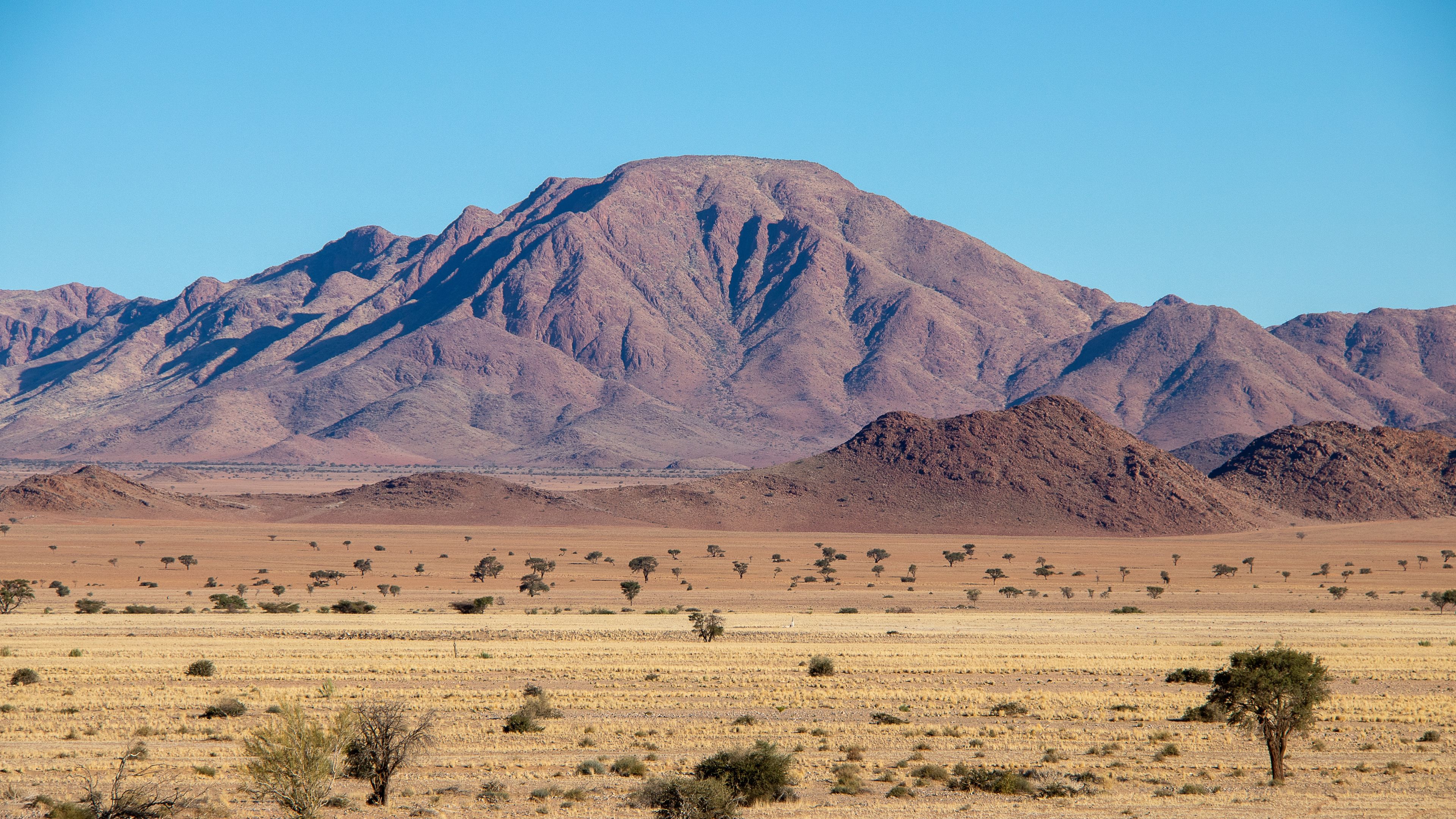
The high-altitude challenge
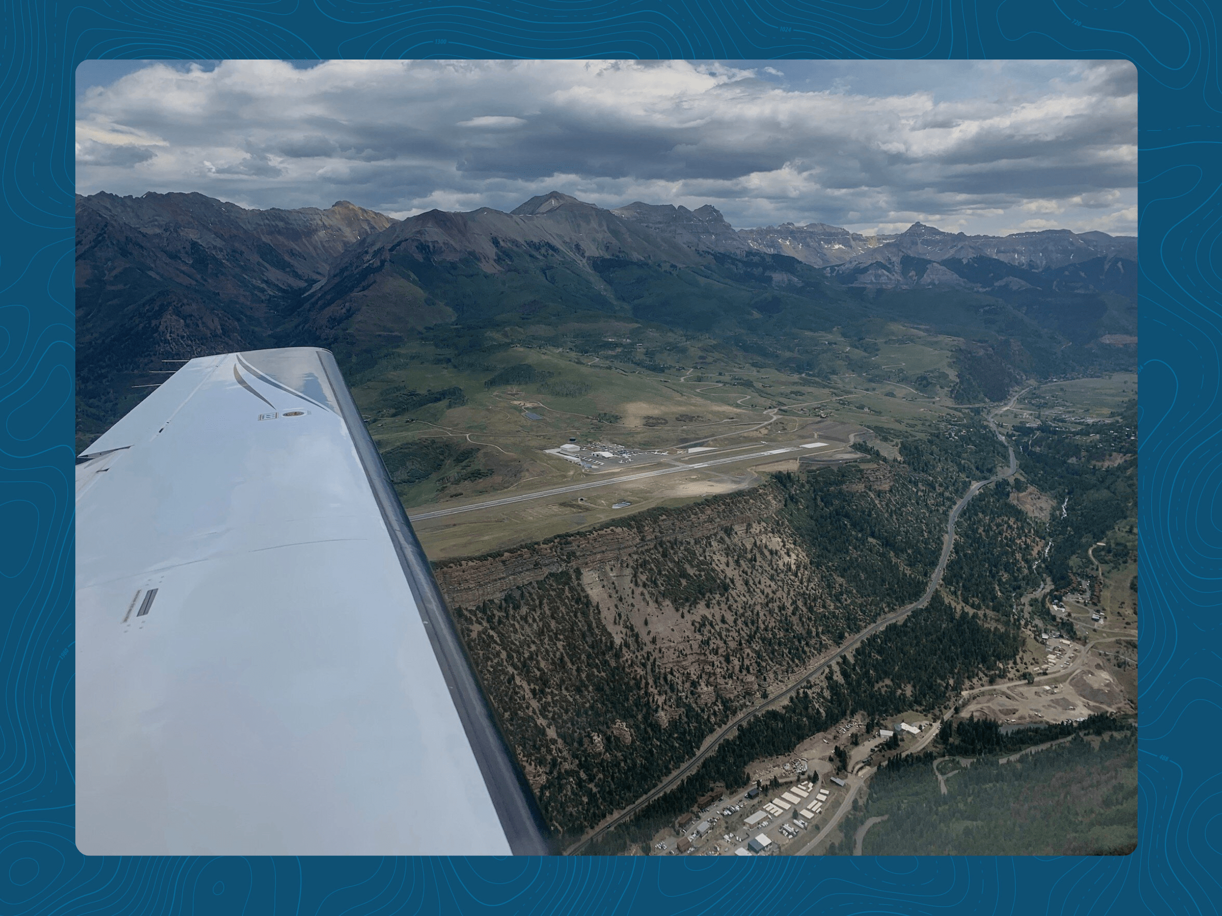
Telluride is the highest commercial airport in North America at 9,078 feet MSL. While mountain airports like Aspen challenge crews because of the surrounding terrain or steep approach paths, Telluride is a bit unique; the 7,111-foot runway sits on a narrow strip of land with steep drop-offs at both ends, creating an environment that alters depth perception, amplifies wind effects, and leaves little room for indecision.
Unlike airports in a valley, where terrain rises around you, Telluride’s open plateau exposes aircraft directly to the wind coming across the nearby peaks. Downdrafts and turbulence form directly above the approach end of the runway, creating rapid changes in lift and airspeed during the final seconds of the flight.
Visual illusions and perception challenges
Because the runway sits on a mesa¹, common visual illusions can affect pilots’ perception during approach.
- Runway width illusion: The runway at KTEX is narrower than many crews are used to, making the aircraft appear higher on approach than it actually is. This can lead to a shallower descent path and a risk of landing short if not corrected early.
- Runway and terrain illusion: When approaching from the west, the subtle up-slope of the runway and surrounding terrain can create the impression of being too high, prompting a lower-than-intended approach. Conversely, when departing or approaching from the east, the sharp drop-off from the mesa can create the opposite effect, making the aircraft appear lower than it is and encouraging a high-energy, unstable approach.
These illusions become even more pronounced when visibility is reduced or light conditions are low, both of which are common in mountain flying.
Traffic patterns and operational flow
Most operators land on Runway 9 and depart on Runway 27 whenever conditions allow. Similar to Aspen, this one-way pattern minimizes exposure to the rising terrain east of the airport but creates challenges when winds shift or runway surface conditions deteriorate. Strong westerly or northerly winds can disrupt the flow, forcing crews to weigh tailwind limits against terrain and climb performance constraints. Telluride rewards precision and punishes complacency.
.png)
What makes Telluride so challenging
The beauty of mountain airports can’t be overstated, and neither can the complexity. From the thousands of pilots who fly into Telluride every year, most face the same set of challenges due to the airport's unique design, its location, and the way aircraft must maneuver to reach it.
Sudden loss of lift
One of the most pronounced hazards at KTEX is the sharp transition in vertical airflow as aircraft cross the mesa boundary. Winds travel down the runway and spill over the edge, creating an abrupt downdraft that can momentarily cause an aircraft to sink if the airspeed is too low. This leads to rapid energy loss at the exact moment crews need it most.
.png)
Climb-limited scenarios on missed approach
Telluride Regional is one of the few airports where the missed approach profile, not the runway itself, can be the primary performance limiter. To climb out of the terrain east of the field, aircraft need strong, sustained climb performance through 11,000–14,000 feet MSL. On hot, high-altitude days, even a modest increase in weight can push an aircraft outside its performance margins.
A go-around that’s technically permissible on paper can quickly become irrelevant if winds, temperature, or pressure altitude shift during approach.
Rapid weather changes
Mountain weather can be unpredictable, especially when the airport isn’t sitting in a valley protected by tall peaks. Snow can move in quickly without warning, and blowing snow can degrade braking action minutes after a plow passes.
In the winter, operational risks often come from:
- Rapid shifts in braking effectiveness
- Short effective landing distance
- The lack of level terrain beyond the pavement
- The difficulty of salvaging a long flare or float
When crews are calculating stopping distance, it should be treated as an evolving number and regularly updated as the flight progresses.
Current Industry Challenges
Manual tools struggle to keep up
Many operators rely on manual charts or static performance numbers that assume stable conditions. At Telluride, conditions do not stay stagnant and can change minutes after leaving the ramp.
Energy management
Approach and landing performance tools generally focus on distance and required runway length. What they don’t capture well is the energy state of the aircraft in the final few hundred feet.
Disconnect between dispatch and crew
Telluride Airport is very scenario-driven. There are no “typical” takeoffs and landings. A weight change, an extra passenger, or a slight shift in wind direction can significantly alter whether the aircraft can meet its climb requirements after takeoff or during a missed approach.
When dispatchers and pilots use different tools or reference slightly different weather snapshots, they can inadvertently model two different versions of the same flight without realizing it. At most airports, that disconnect just creates inefficiency. At Telluride, it can be straight-up unsafe. Ensuring that all parties evaluate the same data in real time is essential because the viability of a procedure can change far faster than traditional workflows are designed to handle.
Best practices for Telluride operations
Discipline and proper preparation are key to succeeding at Telluride. The operators who fly here consistently and safely tend to follow the same set of habits. Here are a few best practices that help maintain performance margins and prevent last-minute surprises from becoming problems.
Prioritize climb performance early
With a 7,111-foot runway, it’s suitable for most business aviation aircraft. Crews should treat climb requirements as one of the first planning variables and build in conservative buffers for temperature, expected winds, and passenger weight. Performance calculations that work now may not work an hour later, so planning with conservative margins protects the operation when things change.
Choose timing intentionally, not opportunistically
Winter and summer present different challenges at KTEX, but both require careful timing. In the summer, early-morning departure windows offer the best climb performance before the heat raises density altitude. In the winter, the timing is driven by runway condition reports and braking action.
Cross-check winds constantly
Crews should keep cross-checking winds at multiple points during arrival or departure and use the most conservative value when evaluating performance. Winds at the surface, on the mesa, and aloft often disagree.
Protect approach stability
Telluride is not a place to salvage an unstable approach. The safest operators are those who commit to strict stabilization criteria and execute a go-around at the first sign of an unstable approach, well before it’s too late. With limited room to correct and constrained climb performance during a missed approach, decisiveness and discipline become the safest tools in the cockpit.
Keep dispatch and the flight crew on identical data
The safest operators ensure that dispatch and the flight crew always work off the same data. The last thing you want is for a fragmented workflow to introduce latency and inconsistency at the most critical phases of flight. Shared systems, shared data, and shared assumptions keep the entire team aligned.
.png)
Why ForeFlight Runway Analysis matters at Telluride
Runway Analysis provides flight departments with a real-time performance tool designed for high-altitude, terrain-driven operations. It automatically evaluates climb requirements, wind components, density altitude, surface conditions, and limiting factors, using the aircraft’s certified data. Instead of jumping between multiple apps to recalculate takeoff or landing performance, crews can update a single variable and instantly see the updated numbers.
That value becomes especially clear in a place like Telluride. With ForeFlight Runway Analysis, operations standardize how they plan, brief, and verify performance by giving dispatchers and pilots a shared, synchronized source of truth. Everyone works from the exact numbers, under the same conditions, and with the same assumptions, eliminating the guesswork that often appears when plans change.
Mastering Telluride and beyond
Telluride is a real test for even the most advanced operations. The altitude, the mesa-top winds, the illusions, and the limited options if a plan begins to unravel all require a level of discipline that leaves no room for inconsistencies in performance planning. Operators who succeed here are the ones who combine sound procedures, conservative decision-making, and technology that keeps pace with the environment.
To learn more about how ForeFlight Runway Analysis supports safe and confident operations at airports like Telluride, visit our website.
¹ Mesa: A flat-topped formation with steep cliffs, creating unique airflow patterns around mountain airports.
.jpg)